Archive for July, 2008

About that map

Sunday, July 27th, 2008

I was talking to Scott the other day about the map. Specifically how much longer the distances traveled appear recently compared to earlier segments, and yet, how it doesn’t seem possible that Geraldine will finish the trip on time when looking at the map.

The answer to all these questions is that the map on the website is Mercator Projection of the world. It is often used because it accurately shows land shapes, and also shows compass headings as straight lines. On other types of maps, following a northwest course results in a curved line. Anyhow, the disadvantage of the Mercator Projection, is that it distorts the scale of land near the poles — the farther north and south you go, the more the map shows features larger than it should be compared to features at the equator.

To put that in context of the Northwest Passage, Greenland is not really as big as all of North America, it is only slightly larger than Mexico. So the farther north our adventurers travel, the more distance they will cover on the map each day (assuming they don’t slow down!). This will allow them to finish the trip on time!

For more on the Mercator Projection visit wikipedia:
http://en.wikipedia.org/wiki/Mercator_projection
Day of Rest

Saturday, July 26th, 2008

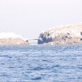
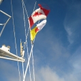
We stayed put all day and rested, worked radio issues etc. I understand the SSB radio a lot better but am not sure we are any better off. Much of the ice seems to be gone as we look out; we’ve been quite secure here. We raised the Nunavut flag today in a very “informal” ceremony. Charlotte, Pat’s Admin, is working spare parts and logistics; pray for devine connections.

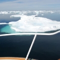
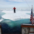
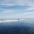
I somehow forgot to report yesterday that Shane got off the boat and lept to a bergy bit. We took pictures of him and he us. We did go back & get him; he’s way too valuable to leave behind. (Rebecca, you will love this post – especially now that it is after the fact. After all, how many people have been adrift on an iceberg in the arctic? You will love the pictures.)

Water temperature is 36 degrees, air temp is 45.

Nunavut – Ice City

Friday, July 25th, 2008

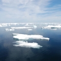
Queen Elizabeth Foreland of the Hall Peninsula (62 deg 22.9′ N, 064 deg 30.4′ W): We had non stop ice today. The Canadian Ice Service says we had 70% coverage, but we think less. We were dodging ice virtually all day. The ice authority says to forget the route through Fury & Hecla Strait. If you look at the NW Passage Page > Possible Routes, we’ve eliminated #1 as a possibility. We are finding that our charts lack the detail we’re accustomed from more “civilized” areas, so we are like early explorers. We saw many mirages today too, even a fishing boat that disappeared and was not on radar.

We had problems again with the water maker, and are trying to arrange delivery of replacement parts. In the mean time, the water tanks are full.

I am working on learning how the long range SSB radio works and weather fax too. There is time for tinkering as we run all day. Not a very eloquent post, but we are all tired. We are going to try and rest longer tonight.

Safe Departure

Friday, July 25th, 2008

All was well with the bears for the night and we are off at 6 AM after Pat fished for a half hour (skunked.) We have AMAZING pictures of the bears – some very close with Pat’s telephoto lens…


I am with you and will watch over you wherever you go — Genesis 28:15